Gangneung
 |
The city hosted all the ice events for the 2018 Winter Olympics.
Gangneung was the home of the Yemaek people in ancient times and became the land of Wiman Joseon in 129 BC. In 128 BC, Nam Ryeo, the army officer of Yaekam, punished Wujang of Wiman Korea and became the territory of the Han dynasty. In the 14th year of Goguryeo Muchheon (313), it entered Goguryeo territory.
In 639, Silla occupied this place and ruled it as a 'Sogyeong'. In 658, King Moo-yeong abolished the Sogyeong and made an arsenal to send the todok, because it was adjacent to Malgal. In 757, it was renamed Sungju and restored it in 776.
It was renamed Myungju again during the Goryeo period, and it was under the jurisdiction the north of Chuncheon in the 14th year of Sungjong (995). It separated the Hamgyeong-do from the Gangeung and called it Gangneung-do, but it has always been the center of administration and military. At the beginning of the Joseon Dynasty, it called to Hwadangdo and Wonchundo and rename Gangneung by the name of Gangwon Province in the 5th year of King Sejong (1423).
Some areas have been incorporated into Yangyang since 1945, and Gangneung City was established in 1995 as the areas of Gangneung and Myeongju merged.
On 18 September 1996 a North Korean submarine ran aground near Gangneung in an attempted infiltration mission, spurring a 49-day manhunt for the escaped passengers. For more details, refer to the 1996 Gangneung submarine infiltration incident.
Map - Gangneung
Map
Country - South_Korea
 |
 |
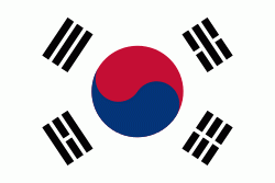
| Flag of South Korea | |
The Korean Peninsula was inhabited as early as the Lower Paleolithic period. Its first kingdom was noted in Chinese records in the early 7th century BCE. Following the unification of the Three Kingdoms of Korea into Silla and Balhae in the late 7th century, Korea was ruled by the Goryeo dynasty (918–1392) and the Joseon dynasty (1392–1897). The succeeding Korean Empire (1897–1910) was annexed in 1910 into the Empire of Japan. Japanese rule ended following Japan's surrender in World War II, after which Korea was divided into two zones; a northern zone occupied by the Soviet Union and a southern zone occupied by the United States. After negotiations on reunification failed, the southern zone became the Republic of Korea in August 1948 while the northern zone became the communist Democratic People's Republic of Korea the following month.
Currency / Language
| ISO | Currency | Symbol | Significant figures |
|---|---|---|---|
| KRW | South Korean won | â‚© | 0 |
| ISO | Language |
|---|---|
| EN | English language |
| KO | Korean language |


